
Thanks to
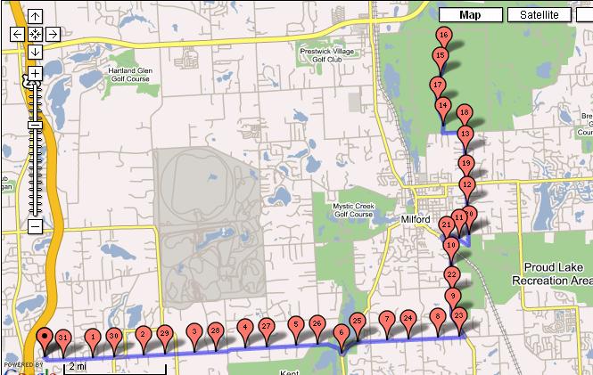
Dan S, I decided to try the gmap-pedometer program to map out my routes better than Microsoft Streets and Trips. The program is sweet. I mapped out my ride from yesterday and it shows about the same distance as my other map(I didn't include my 1.5mile warmup around my sub on either of them). This
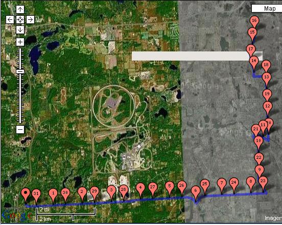
Google program also lets you see your route on Satelitte image and it also shows your altitude change. For a free internet program, this is awesome.

Click this link to see the map and altitude.

3 comments:
you got some nice changes in that route. glad you like it.
Yeah, I really like that elevation graph. I didn't realize that there was that much change in the elevation. Just better for the legs
Thanks for the link to the Google program!
Loo
Post a Comment